
By Adnan Adams Mohammed
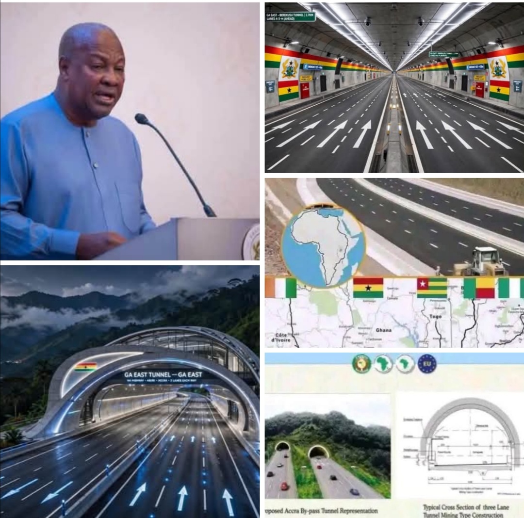
In a major infrastructure milestone, the Government of Ghana is finalizing plans for a landmark 2.7-kilometer road tunnel designed to bypass the nation’s heavily congested capital.
The project forms a central component of Ghana’s segment of the flagship Abidjan-Lagos ECOWAS Highway, aiming to facilitate seamless cross-border trade across West Africa.
The engineering feat will be Ghana’s first long-distance road tunnel, cutting beneath the Akuapem mountain range between Ga East in the Greater Accra Region and Aburi in the Akuapem South District of the Eastern Region. By tunneling directly through the terrain, engineers aim to protect local forest reserves while eliminating the need for freight vehicles to navigate the steep, hazardous climbs of the Aburi Hills.
Speaking on the alignment and strategic vision for the expressway, official sources from the Ministry of Roads and Highways confirmed that the design phase is actively underway.
“This tunnel is a transformative piece of engineering for West African logistics,” a senior ministry representative stated during a technical briefing. “By creating an underground pass through the Akuapem range, we are preserving vital ecosystem habitats while delivering a high-speed corridor that completely bypasses the gridlock of central Accra.”
Redefining the Coastal Transit Corridor
Unlike the existing N1 highway that cuts through urban hotspots like Kasoa, Weija, and central Accra, the new ECOWAS highway will diverge significantly to maintain expressway speeds with minimal urban friction.
Under the proposed alignment, the road will bypass Accra by veering off approximately 15 kilometers east of Winneba. It will head northward through the Akuapem range via the new tunnel, pass near Miotso, and head east into the Volta Region toward the border post at Akanu.
The complete Ghanaian section covers key logistics nodes across six regions, organized into two primary segments:
● Lot 1 (110 km): Connecting Elubo at the Côte d’Ivoire border through Esiama and Daboase to Apimanim Junction.
● Lot 2 (466 km): Spanning from Apimanim through Cape Coast, bypassing Accra via the Aburi tunnel route, crossing through Dawhenya, Sege, Sogakope, Akatsi, and ending at the Akanu/Aflao border in the Ketu North district.
In total, the proposed route will pass through or near 32 local communities across six regions, prompting comprehensive social and environmental impact assessments.
Balancing Infrastructure and Community Needs
Regional planners and civil society leaders have welcomed the economic potential of the highway while emphasizing the need for equitable community support.
“Connecting our major trade ports from Elubo to Aflao without sending heavy freight directly through downtown Accra will save millions of hours in lost productivity,” noted an urban transport strategist based in Accra. “The shift away from the traditional Winneba–Kasoa stretch is essential if we want this project to operate as a true, high-capacity international corridor.”
Community representatives in the impacted areas have also voiced expectations for local infrastructure enhancements as engineering preparations continue.
“While we welcome the trade opportunities this historic tunnel and expressway will bring to our districts, the government must ensure that the 32 affected communities receive fair engagement and adequate infrastructure upgrades,” said a local council representative from the Ga East municipality.
Final design blueprints and budget allocations for the project are expected to be officially presented during the presentation of the 2027 National Budget Statement.
